Location Intelligence
Location Insights in Decision-Making

Unlock location insights that drive superior business outcomes
Location & Business Intelligence
Location Intelligence (LI) provides invaluable insights into decision processes that people make when they work, shop, or relax.
Business Intelligence (BI) can enhance insights into patterns of consumption, solve business problems, optimize costs, and uncover new solutions.
We combine LI and BI to provide a deeper understanding how people engage with places can help inform market analytics, customer engagement, and cost optimization strategies for almost every industry segment.
Location Based Services (LBS)
A single infrastructure to address multiple use cases.Our solution integrates many different pieces of technology to answer the great majority of customers’ needs.
Geovisualization can uncover previously unknown relationships in your data. The use of tools like visual heat maps or hotspot analyses are rarely leveraged in corporate decision making. We provide services to bridge these critical gaps.
Data Collection from Multiple Sensors & Gateways
- Build IoT sensors for capturing location-aware data
- Develop data capture and storage capabilities
- Model uncertainity in unstable data pipelines
- Create multi-industrial protocols for sensing and geolocation
- Design and implement scale-specific geolocation devices
Geospatial Data Management
Optimize how location data is captured and stored within your enterprise database systems to provide seamless integration with other data functions within the organization.
Integration of geospatial data with other dataset present several challenges due to differences in resolution and quality. Understanding the impact of integration and developing systems for reducing bias in decision making.
Developing Business Applications with Geospatial Data
- Identify location parameters efficiently
- Integrate spatial data streams with BI tools
- Optimization of geospatial data stores
- Share location insights through maps
- Develop geovisualization apps
- APIs for data automation
Geospatial data can be attached to many critical attributes to give you a well-rounded profile of your customers and clients. Being able to map the locations of your customers, their movement trajectories, location preferences, and a multitude of information about their neighborhoods can help your tailor your solutions to meet the specific needs of your customers.

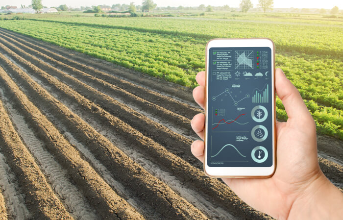
Use location modeling to optimize farm management practices. Gain insights into production parameters to optimize costs. Leverage weather data at the macro and micro scale to achieve operational efficiency. Track market-specific commodity prices. Compute transportation and other costs.

Create development strategies to examine how consumer spending patterns and movements across places can be used to enhance plans for retail store placement and expansion. Cost optimization that considers capital investments, potential traffic, and urban growth patterns are critical for staying competitive.

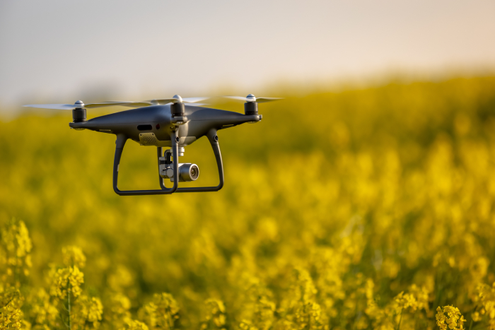
Use AI-based solutions, including machine vision, for automated identification of pests and diseases. Reduce costs by optimizing harvest locations and timing. Early intervention to eliminate localized pest and disease outbreaks.

Create development strategies to examine how consumer spending patterns and movements across places can be used to enhance plans for retail store placement and expansion. Cost optimization that considers capital investments, potential traffic, and urban growth patterns are critical for staying competitive.
Geospatial data can be attached to many critical attributes to give you a well-rounded profile of your customers and clients. Being able to map the locations of your customers, their movement trajectories, location preferences, and a multitude of information about their neighborhoods can help your tailor your solutions to meet the specific needs of your customers.
AI-based solutions for identifying optimal crop harvesting patterns. Reduce costs & improve profitability by identifying the right time for harvesting.
Manage farming schedules. Track commodity prices. Compute transportation and other costs.

LBS: The Solution at a Glance
Location Based Services (LBS)
A single infrastructure to address multiple use cases.Our solution integrates many different pieces of technology answer to the great majority of customers’ needs.
Collect data from multiple sensors & gateways
- Multi-protocol solar powered gateway,
LPWAN gateways, IP gateways… - Multi technologies geolocation devices
Upload data to the cloud without specific infrastructure
- Gateways connected to
2G/3G/4G/5G/IP networks using
multi-operators SIM cards
Develop business applications leveraging the production data streams
- Powerful Business Intelligence
tool - Open API to expose data
Technologies & Software
Our experts can leverage and deploy open source GIS tools, including PostgresSQL (PostGIS) for spatial data management, Geoserver for spatial data distribution, and DataHub for data cataloging.
We have established partnerships with a number of COTS GIS providers including Alteryx, Esri, Caliper Corporation, Carto, and Precisly.
We can design and deploy Global Position System and remote sensing technologies for retail, mapping, and precision agriculture. Our partners include Trimble, Magellan, MapShots, ClimateCorp, AgroSense, Sentera, and others.
